
Borwick and Priest Hutton Heritage Trail
Historical Background
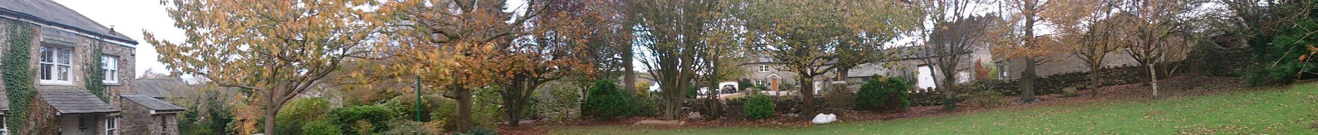
Introduction
There is some evidence of Bronze Age occupation in the form of two monuments (cairns), one of which was excavated in the early 1980s and the other, barely discernible in the centre of a green field, remains unexamined. Both are on land surrounding Manor Farm on the western edge of Borwick. The cairn dates from the early Bronze Age with construction thought to have been carried out in the period 1740 BC – 1640 BC. Traces of an even earlier occupation during the late neolithic period were also found in the form of worked flints, mostly arrowheads.
The first historical record of the community is found in the Doomsday book of 1086.Priest Hutton was originally listed as Hotun and later as Nether Hutton. By 1307 it was referred to as Presthotone designating it was land where agricultural rents were paid to the church.
Borwick was first mentioned in the Domesday Book as ‘Bereuuic’ with, literally, a double ‘u’. This was likely a corruption of the name Berwick, meaning an area important as a source of barley.
Archbishop Matthew Hutton was born in Priest Hutton in 1529, and, being educated at Cambridge, adopted Protestantism and became one of the leading divines in England following the accession of Elizabeth I. Thomas Wilson, 1747–1813, master of Clitheroe School, was another local man and was identified among the rectors of Claughton.
A branch of the old Lancaster and Kendal Road goes through the western end of Priest Hutton and from it a minor road extends south-east to the village, and then turns south to Borwick. The railway from Carnforth to Wennington runs through the eastern end of Borwick, near to the river Keer. The Lancaster and Kendal Canal crosses the extreme south-west corner of the community.
Geology & Physical geography of the community
The geology of the area is not immediately obvious from walking through the villages of Borwick and Priest Hutton. Field boundaries are a mixture of dry-stone walls and hedges. The underlying rock is of carboniferous limestone which is rarely visible on the surface but has been widely used in the past for the buildings and walls of the area. As you walk around the villages see if you can spot the local stone mix in the older properties (limestone, sandstone and gritstone), this was quarried locally from sites off Upphall Lane and Borwick Lane.
The landscape we see today is the result of the various ice ages, the last being roughly 13000 years ago. As the ice melted the rocky debris within it was left as a thick layer of boulder clay, which as its name suggests contains boulders and cobbles. These have been hand cleared from the fields for use in drystone walls and as building stone. The area is noted for its drumlins; these are the long-rounded ridges and oval shaped hills made up of glacial material left after the glaciers retreated. In places the material has been sorted and graded by the flow of water leaving large deposits of sand and gravel. These have been commercially exploited in the Dockacres area and having filled with water, are now seen as the lakeside developments adjacent to Borwick.
The main road through Priest Hutton curves around flat low-lying fields which bear all the signs of once being the bed of a lake or marsh left after the glaciers retreated, and only became usable after the construction of drainage ditches. Certainly, the line of the road through the village has followed the higher and drier land for its construction.
To the east of the two villages the tracks follow higher ground and in places it becomes obvious from the more acidic soils and boggy ground that the underlying rock is different. This is due to the presence of older sandstone and shales. There is some evidence that this was exploited in the past for building purposes, but because of its soft nature has been used only in some of the older buildings.
Limestone was quarried on a small scale near Green bank and Green Hill in Borwick. Maps of 1840 show lime kilns nearby at Taylors Bridge and Green Bank Borwick and near Beech House in Priest Hutton. The kilns would have produced lime for fertiliser and for mortar in the local buildings.
Manorial history
In 1066 Hutton was, like Warton, one of the manors held by Torfin of Austwick. It was probably granted later to the Lancaster family and assigned by them to the endowment of Warton Church, thus acquiring its distinctive prefix. One moiety (portion) of the manor appears to have been retained by the rectors of Warton in demesne, forming an important part of the rectory manor, which included lands also in the remaining townships of the parish.
The other moiety was held of the rectors by the Lancasters of Caton and their successors, Harrington and Mounteagle. Other land, though not formally called a part of the manor, was held by the Crofts of Tewitfield for the rector of Warton. In 1331 a fourth part of the manor belonged to a family surnamed Hutton; of whose history nothing is known. In 1594 Lord Mounteagle sold or mortgaged his manor of Priest Hutton to Robert Bindloss, by whom it was treated similarly to his management of Borwick Hall (see below).
The Crofts estate is later found in the possession of Washington, Lawrence and Middleton of Leighton. One or two other names occur in the inquisitions, but it does not appear that any manor is claimed now.
Whitebeck Mill entered the historical record in 1560 when it became the subject of a dispute between Richard Ashton and George Middleton. The latter claimed it under a lease from Lord Mounteagle to Middleton’s father Gervase, and when the plaintiff cut off the stream of water Lord Mounteagle ordered it to be turned on again. It seems strange to think that such a small stream as Whitebeck could have once powered a watermill.
The Foundling ArchbishopÂ
The most famous son of Priest Hutton, Matthew Hutton, was appointed Archbishop of York by Queen Elizabeth 1st. It was a time when religious wars still raged across Europe. He seems to have been highly regarded as a cleric and thinker and although he was a keen advocate of the Protestant religion, which had only recently been introduced by Henry VIII, he treated Catholic recusants with care and compassion. He preferred persuasion rather than the more brutal methods of some in the church. It seems he had little time for puritans: “their fantastical zeale, I mislikeâ€.
There is a local tradition that he was a foundling baby, left on the doorstep of Beech House farm in 1529, or, alternatively, at the nearby Janet’s (or Jennet’s) Well, a few yards down the hill and that he took the name ‘Hutton’ from the place he was found. Historians dispute this, however. John Lucas, writing between 1710 and 1744 was most indignant on the subject: “The most Reverend Father Dr Matthew (son of Mathew) Hutton, was ​ not ​ a foundling child as some have falsely published, but was born…. of honest parents in this townâ€. ​
Who knows? It’s a good story though and links a national figure to local features. Janet’s Well can still be seen, and the original Beech House still stands on the opposite side of the road to the later one, its features almost lost in the stone barn it has become.
Matthew Hutton was educated at a local school in Warton and then went as a ‘sizar’ (a subsidised student) to the University of Cambridge. There he distinguished himself and went on to become Master of Pembroke College in 1562. In 1567 he was offered the post of Dean of York, later becoming Archbishop. During his lifetime he appears to have accumulated considerable wealth and property, but he did not forget his humble origins. He endowed a school in Warton. Archbishop Hutton primary school is still there and thriving.
Borwick Hall
The reference to Borwick is in the Doomsday Book lists it as land gifted to the estate of Roger of Poitou, following the Norman conquest. It is probable that the first defensive structures there were constructed from wood. The earliest stone structure on the site is a Pele tower built in the reign of Edward III, most probably as a defence against Scottish raiders.
Around 1590 the property was purchased by Roger Bindloss a wealthy textile merchant from Kendal. He began the work of extending the tower into the Manor house and much of what we can see today comes from that period. The builder, Alexander Brinsmead, very usefully carved his name in stone at the top of the staircase, with a date of 1595.
Of particular architectural interest, in addition to the original Pele tower, are the Gatehouse and the packhorse stables. These were added in the middle of the 17C and are thought to have served the transport of local cloth to the markets in the south. The Gatehouse itself carries a date stone bearing the inscription R R 1650. This refers to the then occupants Rebecca and Robert Bindloss who himself became MP for Lancashire in 1660.
At the time of Robert’s death in 1688 there were no male heirs and the property passed to his eldest daughter Cecilia, wife of William Standish. Once again there were no male heirs and on the death of Cecilia the property passed to their eldest daughter Elizabeth who had married Thomas Strickland of the Sizergh family.
The Hall remained in the Strickland family until 1854 when it was sold to a Colonel Marton of Capernwray. Unable to afford the upkeep the Marton family allowed the Hall to fall into disrepair and in 1910 it was finally leased to John Alexander Fuller Maitland, the then music critic of the Times. The terms of the lease required, in return for a very modest rent, that Maitland restore and repair the building. Whilst in residence Maitland became the subject of a scandal when he was found to have falsified the facts in a critique of the composer Arthur Sullivan.
During World War II the Hall was used as a military base before being sold to the Lancashire Youth Clubs Association and afterwards to Lancashire County Council, the present owner.
Borwick Hall and the English Civil War
Sir Robert Bindloss (a descendent of the original Bindloss purchaser of the hall, also a Robert) was elected as Member of Parliament for Lancaster in 1640, at the age of 16. He was a supporter of Parliament during the Civil War, but he seems to have had some Royalist sympathies. Indeed, he was knighted by Charles 1st. In August 1651, when the future Charles 2nd was heading south with an army of 14,000 Scots, Sir Robert diplomatically absented himself from Borwick Hall, leaving a young lady to entertain the royal visitor and local legend has it that the liaison produced one of his many illegitimate children.
The bulk of the army, including a considerable contingent of cavalry and artillery, camped overnight in the meadows beyond Keer bridge on the west side of Kellet lane. Some of this land has since been lost to the M6 motorway. They rested here on the 10th or 11th of August 1651 before resuming their journey south. They met the (New Model) Parliamentary army, under the command of Oliver Cromwell, about three weeks later on 3rd September at Worcester. It was not an equal match, and more than 3000 Scots were killed, against only 200 deaths among Cromwell’s men. The rest were either captured or ran away. The captives were transported to the New World as indentured labourers.
Roads, turnpike, tracks, canal and railway
The earliest north-south road was probably a drovers’ road bringing livestock from the Scottish borders and beyond, to markets in the south. It would have come south via Kendal to Burton in Kendal and then on to Tewitfield. At Tewitfield it would have turned left down Kellet Lane and then right at Nether Beck and on into Carnforth along North Road. From Carnforth it would have followed the old Roman road to Lancaster via Slyne.
The advent of the industrial and agrarian revolutions, the development of urbanisation and rapid increase in population in the 18th century, saw many dramatic changes throughout Lancashire. The necessity for improving transport infrastructure led to the construction of Turnpikes. The Garstang & Heron Syke Turnpike was approved by Act of Parliament in 1751. The Turnpike Trust had the mandate to, “to repair, upgrade and maintain the main road”. In return for this work, they would charge the traveller a toll to use the road. The Heron Syke Turnpike eventually became the route of the A6/A6070.
In 1871 the government stopped renewing the Turnpike Trust’s licence, effectively ending this type of road funding, and control was now transferred to the local authority. This was the start of the era of motor transport and from about 1900 most of the roads’ surfaces were sprayed with tar to stop cars throwing up dust and gravel from the old road surface. After World War 1 the road network was reorganised and road numbering was introduced.
The most significant and probably the oldest east-west route is the appropriately named Borwick Lane. The road leads from Priest Hutton to Borwick and then onwards to Warton via Dock Acres, the site of the medieval Mourholme Castle. Borwick Lane heads north from Borwick to Kirkby Lonsdale via either Arkholme and Whittington or by way of Melling and Tunstall.
The only ancient road that still exists as an unimproved stoned track is Kirkgate. This leads from Whitebeck Lane in Priest Hutton to the former Methodist Chapel on Kellett Lane, Tewitfield. It can also be traced over the road and continues as a footpath in the direction of Warton, via a footbridge over the motorway.
The Chapel on Kellett Lane is thought to have been originally used as an ale house by the navvies that constructed the adjacent Lancaster canal and Tewitfield basin. The construction of the canal was approved by Act of Parliament in 1792 and was originally intended to connect Westhoughton to Kendal via Preston and Lancaster. The canal’s principal purpose was to transport coal north from the Lancashire coalfields, and limestone south from Cumbria. The nature of these cargoes gave the waterway its local nickname – the Black and White Canal. The Preston to Tewitfield section of the canal was opened in 1797 and the Tewitfield to Kendal section, including the flight of eight locks at Tewitfield, opened in 1819.
The final transport route to be constructed through the parishes was the Furness and Midland Joint Railway line. This went from Carnforth to Wennington (see the map to the left). The line was opened in 1867 with a station at Borwick. The station closed in 1960 and the buildings have since been converted to private residences. The line is still in use today as part of the Leeds to Morecambe train services.
Farming over the centuries
Pre-16th Century
Signs of the medieval ridge and furrow system of Open Field agriculture are to be seen throughout Borwick and Priest Hutton. The strips are most easily seen in the spring and autumn when the sun is setting or in winter following a light dusting of snow. The strips in each field were randomly shared between the villagers so that good and bad soil was shared out equally. The land was ploughed by oxen in long strips because the ploughs were impossible to turn. The plough was unhitched at the end of each furrow, the oxen turned and then the plough reattached. Medieval farming in Borwick and Priest Hutton was essentially subsistence farming and often a communal activity.
The seasonal pond to the east of Upp Hall Lane in Priest Hutton and the flood meadow to the west of the War Memorial Hall in Borwick were used for the retting of flax and hemp. The coarse cloth made from these fibres was largely for local domestic use, echoes of which can be detected in Priest Hutton where one property is called Hempstead. In addition, the field on the north side of the junction of Kirkgate and Whitebeck Lane is named as St. Ann’s Hempland on the 1846 Tithe map.
The heating of dwellings during this period was mainly by peat, which was cut from the higher common lands in the two parishes. Once cut, the peat turves were spread out to dry by wind and sun. When dry they would be wheelbarrowed down to be stored near the cutter’s house for use in the winter.
16th Century
By the beginning of the 16th century the random strips had been amalgamated into small holdings and by the end of the century much of the agricultural land had been enclosed by hedges and walls.
The main crops produced were oats and barley sown by the men of the villages, followed by the planting of peas and beans, in potagers, which was a mainly female task. Approximately 40% of the land was under arable cultivation and 50% was used as pasture. The remaining 10% was woodlands. Farm stock were oxen, cows, sheep and horses. Most households kept a pig and also chickens for eggs. Given the deteriorating weather in the 16th century most agriculture continued to be subsistence mixed farming with little in the way of a commercial surplus.
17th Century
Farming in the two villages, in the 17th century, followed the traditional three field crop rotation system whereby each field was left fallow every third year for livestock grazing and nutrient replacement by natural fertilisation. The proportion of land used for stock to arable was higher in Priest Hutton and the converse was true in Borwick. In the early 18th century Warton schoolmaster John Lucas described Borwick as “a pretty little village†with “plenty of grain growing about this townâ€.
The inventories contained in the wills of this period show that the value of livestock farming was roughly twice that of arable farming.
18th Century
As the 18th century progressed the small holdings and enclosures arising from the amalgamation of the original medieval strips were gradually consolidated into larger units. Evidence of these smaller fields can be seen throughout both villages as the grubbed-out hedges have left raised ridges within the larger fields that we have today.
Hemp was still being grown, as evidenced by the sale of hemp flax by Thomas Turner of Priest Hutton in1719. The wills of yeoman farmers typically bequeathed oxen, cows, stirks (yearling cattle), heifers, horses and usually a cheese press, which indicated that farming in the area was mainly cattle or mixed farming. Towards the end of the 18th century oxen were being replaced by horses to plough the fields. This was partly driven by the consolidation of smaller farms into larger units and the consequent increased wealth of these yeomen farmers.
19th Century
The advent of the Industrial Revolution and the rapid growth in population in the towns and cities meant that there was greater demand for agricultural produce both from home and abroad. Lancashire shorthorn cattle were replacing longhorn cattle at the beginning of the 19th century. The agricultural improvements in the south of the country gradually spread to the less productive lands of the far northwest.
A field map version of the 1846 Tithe map but with field names included is available on the Mourholme Society website: http://www.mourholme.co.uk/?Maps
Machinery was replacing and improving the productivity farm labourers. A farm sale in1817 at Uphall Farm in Priest Hutton included a threshing machine and in 1855 Borwick Hall was recorded as having a reaping machine. The days of cutting corn by scythes was disappearing. The mechanisation of farming continued apace; milking parlours, artificial fertiliser, improved seed varieties changed the farming landscape during the 19th century.
20th Century
The first half of the 20th century saw the replacement of the horse by the tractor (remember that the petrol engine’s power was given as units of horsepower!). The number of people working on the land fell dramatically and food became more available from around the world. The farms of Borwick and Priest Hutton became almost exclusively devoted to dairy cattle and the fattening of livestock. Towards the end of the century, it became uneconomic to keep a herd of dairy cows as the price of milk fell so low. The daily sound of the milk tanker was heard no longer. Redundant farm buildings were converted into desirable housing and the shop in Borwick disappeared, as did the shop/post office in Priest Hutton and the Priest Hutton school.
Prior to the 20th century the majority of the people living in the two villages worked in the two villages. That position has now reversed, and the majority of the inhabitants are either retired or commute outside the area to work. Borwick and Priest Hutton now have a significant tourist/leisure industry. Horses are again to be seen on the roads of the two villages, no longer as beasts of burden, but kept for pleasure.